中国安全科学学报 ›› 2026, Vol. 36 ›› Issue (8): 206-215.doi: 10.16265/j.cnki.issn1003-3033.2026.08.0926

• 公共安全与应急管理 • 上一篇    下一篇

城市道路交通系统雨涝韧性评价与时空特征分析

杨金顺1(), 高晓涵1, 王召强2, 张法辉1, 郭传威1, 栾偲良1   

  1. 1 青岛理工大学 智慧交通与运载学院, 山东 青岛 266520
    2 青岛市市政工程设计研究院有限公司, 山东 青岛 266061
  • 收稿日期:2026-02-02 修回日期:2026-05-11 出版日期:2026-08-28
  • 作者简介:

    杨金顺 (1979—),男,山东安丘人,博士,讲师,主要从事交通系统韧性优化、道路交通安全分析等方面的研究。E-mail:

    王召强 研究员

    栾偲良 讲师

  • 基金资助:
    山东省自然科学基金资助(ZR2023QG106); 青岛理工大学滨海人居环境学术创新中心开放基金资助(201812012); 青岛理工大学滨海人居环境学术创新中心开放基金资助(CK-2024-0068)

Evaluation and spatio-temporal characteristics analysis of waterlogging resilience of urban road traffic system

Yang Jinshun1(), Gao Xiaohan1, Wang Zhaoqiang2, Zhang Fahui1, Guo Chuanwei1, Luan Siliang1   

  1. 1 School of Intelligent Transportation and Vehicle, Qingdao University of Technology, Qingdao Shandong 266520, China
    2 Qingdao Municipal Engineering Design and Research Institute Co., Ltd., Qingdao Shandong 266061, China
  • Received:2026-02-02 Revised:2026-05-11 Published:2026-08-28

摘要:

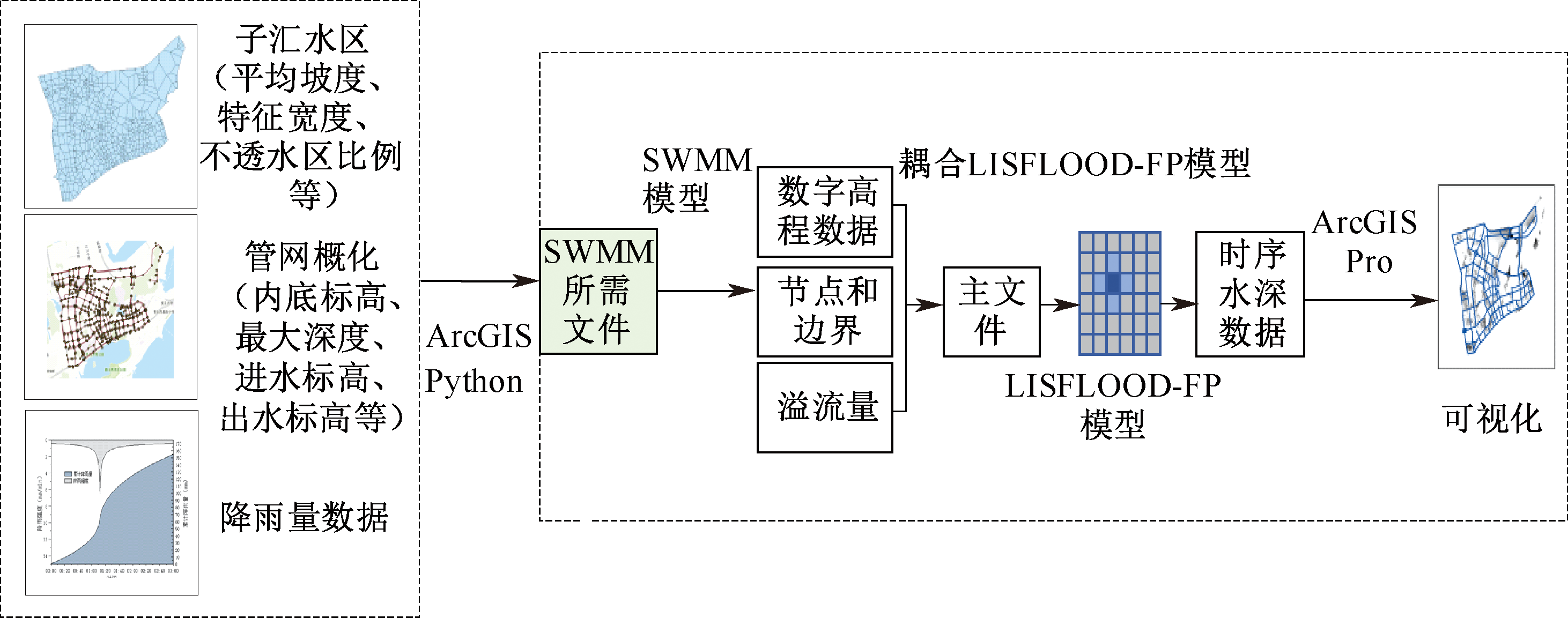
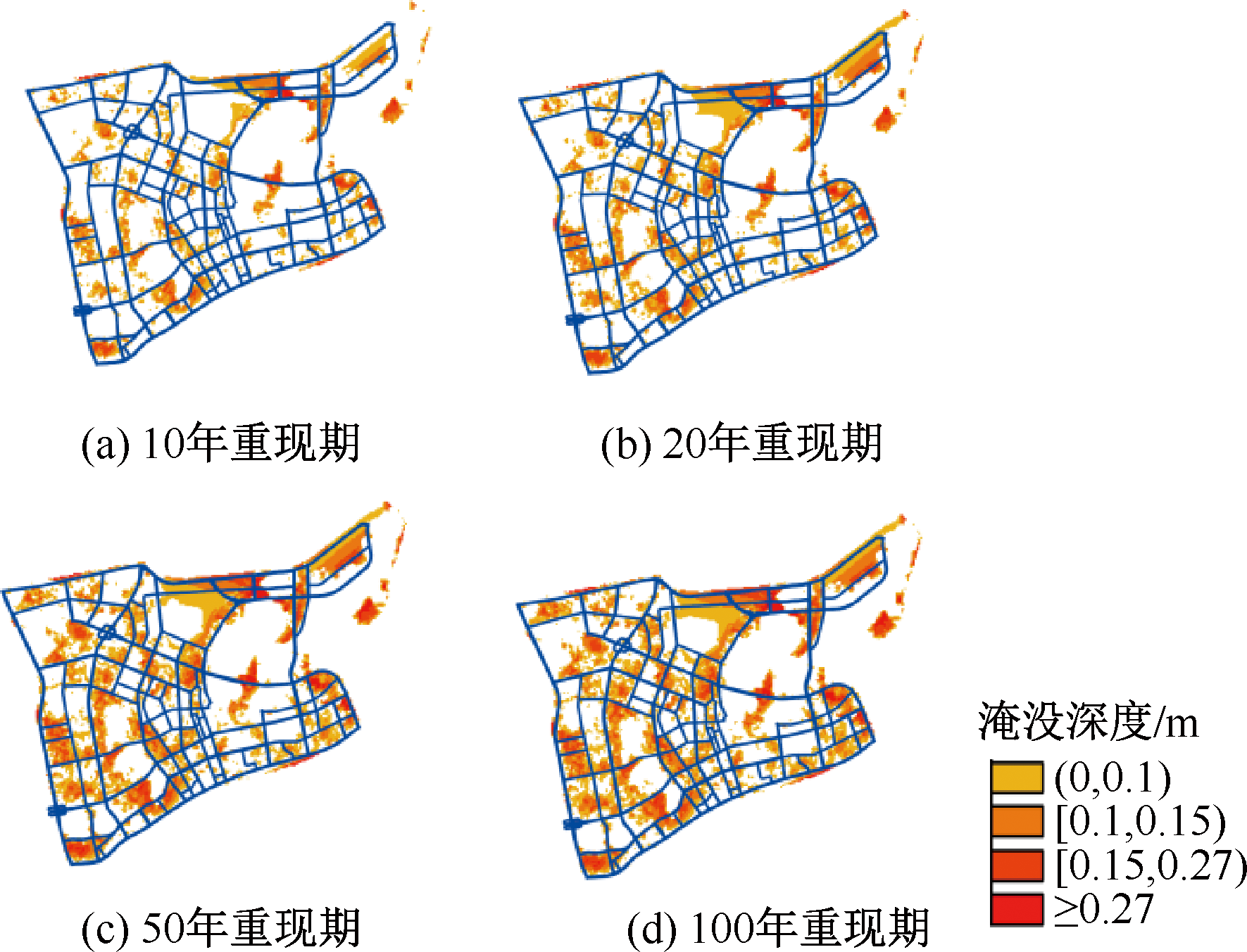
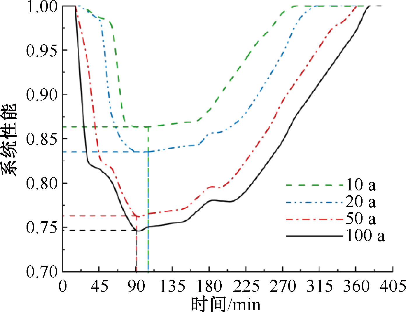
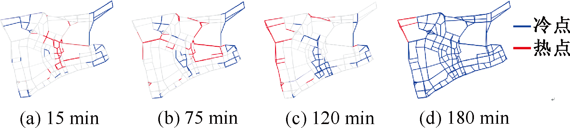
为应对雨涝事件对城市道路交通系统运行造成的干扰,增强系统的适应与恢复能力,构建道路交通雨涝韧性评价模型,分析韧性时空演化特征。首先基于地理信息系统(GIS),构建包括下层雨涝分析模型及上层二维水动力学模型的道路网双层雨涝分析平台;其次引入动态权重函数构建路网拓扑结构动态评价模型,以行程时间比值为交通性能评价指标,综合构建雨涝情景下道路交通系统韧性评价体系;然后运用核密度估计法进行韧性时空动态演化分析,并基于网络全局莫兰指数和冷热点空间分析技术进行韧性空间相关性分析,以揭示雨涝情景下道路交通韧性的时空特征;最后以青岛市开发区道路网为例进行不同降雨强度下道路交通系统韧性案例分析。结果表明:随着降雨强度从10年重现期到100年重现期,道路积水范围、深度及持续时间呈增大趋势,积水峰值时间由105 min提前至90 min,淹没道路占比由4.75%升至20.08%;路网韧性呈衰减趋势,最小值从0.86降至0.74;恢复时间呈延长趋势,滞后幅度达67%。雨涝韧性热点(高值)与冷点(低值)呈聚集分布态势,冷点与雨涝区重合度达80%,热点区域随雨涝范围扩散发生空间转移;道路技术等级越低,受雨涝影响越大,支路失效会形成连片脆弱区;高密度路网在低强度降雨下功能稳定性良好,稀疏路网中关键路段失效会引发空间溢出效应。

关键词: 城市道路, 交通系统, 交通韧性, 雨涝, 韧性评价, 交通性能

Abstract:

In order to cope with the interference of waterlogging events on the operation of the urban road traffic system and enhance the adaptability and recovery ability of the traffic system, a road traffic waterlogging resilience model was constructed to analyze the temporal and spatial evolution characteristics of resilience. Based on a geographic information system (GIS), a two-layer analysis platform of road network waterlogging, including a lower-layer rainstorm flood analysis model and an upper-layer two-dimensional hydrodynamic model, was built. The dynamic weight function was introduced to construct the dynamic evaluation model of road network topology, and the travel time ratio was used as the traffic performance evaluation index. Then, the comprehensive evaluation system for road traffic resilience under waterlogging scenarios was constructed. The kernel density estimation method was used to analyze the temporal and spatial dynamic evolution of resilience, and the spatial correlation analysis of resilience was carried out based on the network global Moran's index and the spatial analysis technology of cold and hot spots, so as to reveal the temporal and spatial characteristics of road traffic resilience under waterlogging scenarios. A case study on the resilience of the road traffic system under different rainfall intensities was conducted using the road network in Qingdao Economic Development Zone as an example. The results show that as rainfall intensity increases across scenarios with return periods ranging from 10 to 100 years, the range, depth and duration of road waterlogging show an increasing trend. The peak time of water accumulation advances from 105 min to 90 min, and the proportion of inundated roads increases from 4.75% to 20.08%. The road network resilience shows a decreasing trend, and the minimum value decreases from 0.86 to 0.74. The recovery time shows an extended trend, with the recovery delay increasing by up to 67%. The hot spot (high value) and cold spot (low value) of waterlogging resilience exhibit a clustered spatial distribution. The spatial overlap between cold spots and waterlogged areas reaches 80%, and the hot spot areas shift spatially as the waterlogged area expands. The lower the technical grade of a road is, the greater the impact of waterlogging is, and the failure of local roads leads to contiguous vulnerable areas. The high-density road network has good functional stability under low-intensity rainfall, and the failure of key road sections in sparse road networks causes spatial spillover effects.

Key words: urban roads, traffic system, traffic resilience, waterlogging, resilience evaluation, traffic performance

中图分类号: